

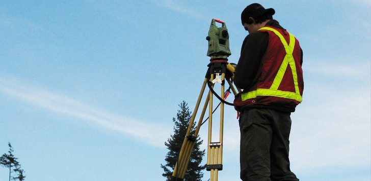
3D Laser Scanning For Land Surveying Posted byadmin Dec-15-2016 Surveying Technology The advancement of technology has made rise to different ways of doing things. One such innovation involving technology is the way land surveying is being done nowadays. Land surveyors are now using the use of 3D Laser Scanning Technology in helping them survey and evaluate land properties and develop architectural designs. With the help of 3D scanning, land surveyors are able to create virtually life-like images of a piece […]
Author Archives: floridaengineersurveyor
Drone Technology In Land Surveying |

Drone Technology In Land Surveying Posted byadmin Dec-15-2016 Surveying Technology Land surveying is a process that needs to be done before accomplishing various activities involving land; for instance, buying, selling, and subdivision. Basically, it is the mapping and measurement of a certain portion of the environment using technological equipment. Land surveyors are professionals who have undergone formal education and various trainings to acquire the exceptional knowledge and skills required for their jobs. What are Drones? Assuming you are someone who […]
Highway Construction Surveying |

Highway Construction Surveying Posted byadmin Dec-15-2016 Commercial Surveying Highway surveying is a specialized type of land surveying generally conducted for government agencies during the planning stages of a highway development project. After the highway is built, a highway survey can be used to provide an accurate layout of roadways, utilities, storm drainage systems, overhead wires, nearby buildings, and other features of the landscape. A construction surveyor is often involved in the placement process for the highway. This requires a survey […]
Land Surveying Myths and Misconceptions |
Land Surveying Myths And Misconceptions Posted byadmin Dec-15-2016 Surveying Land surveying is a complicated business, and for that reason there are quite a few misconceptions about what it is and why people need it. If you are considering whether to have a land survey done on your property (or property you plan to buy), chances are you have fallen prey to one or more of these myths, which have the potential to steer you wrong. To help you out, here […]
Archaeological Land Surveying |

Archaeological Land Surveying Posted byadmin Dec-15-2016 Land Development Archaeological surveying is a specialized type of land surveying conducted to report the finds made in an archaeological site or to show the relationship of the archaeological site to the landscape. This survey is generally undertaken at the request of archaeologist or government agencies and utilizes GIS, GPS, aerial photography, and other tools for surveying. While archaeological land surveys are often conducted at the conclusion of an excavation, land surveying methods can […]
Surveying and Vegetation |

Surveying And Vegetation Posted byadmin Dec-15-2016 Land Development 1 Comment. One of the challenges faced when using traditional land surveying methods is the necessity of surveying areas that are covered by thick vegetation. Some surveying projects require the measurement of such vegetation, while most applications require measurement of the terrain itself, rather than the vegetation covering it. Topographic surveys may or may not require the measurement of vegetation, depending on their intended purpose. When on the ground, land surveyors […]
Monument Land Surveys |
Monumental Land Surveys Posted byadmin Dec-15-2016 Commercial Surveying 1 Comment. A monumental land survey is a type of land survey dealing specifically with the boundaries of the property. All monumental land surveys use physical monuments to mark the boundaries on the land itself. Commonly, the corners of the property are marked with a long iron rod driven vertically into the ground, though there are many other types of physical monuments that may be used. These monuments are designed to be […]
Reasons to Survey Your Land |

Reasons To Survey Your Land Posted byadmin Dec-15-2016 Surveying 1 Comment. Although a land survey may seem tedious and unnecessary, in fact there are many cases in which you should have your land surveyed, to save confusion or legal troubles later. A land surveyor will research available documents concerning your land, including titles and previous surveys. He/she will also physically measure the property, checking these dimensions against the previous records to find any discrepancies. Here are some important reasons […]